
Calidris Cartographic Design
We combine GIS analysis with professional design to create maps that are both accurate and visually compelling. From environmental data to custom cartography, we help organizations and individuals better understand the world through spatial data.
Services
We transform geospatial data into clear, compelling maps for environmental projects, research, and visual storytelling.
Map Editing
We employ an array of professional software and design services for your custom map-making needs.
Data Visualization
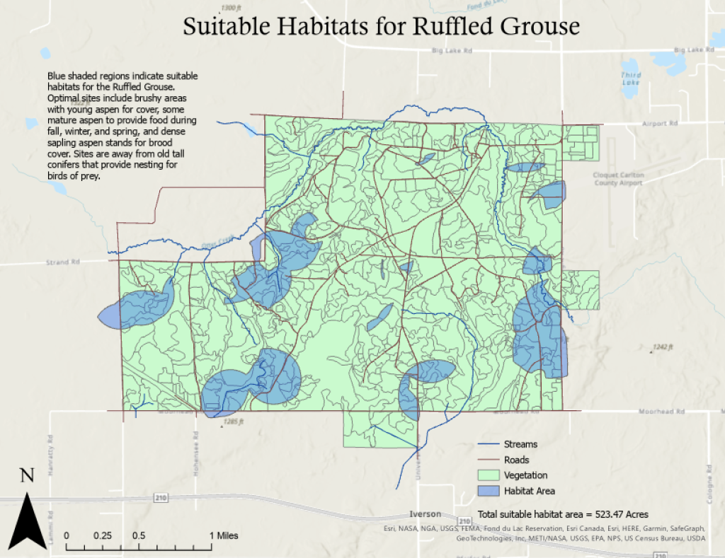
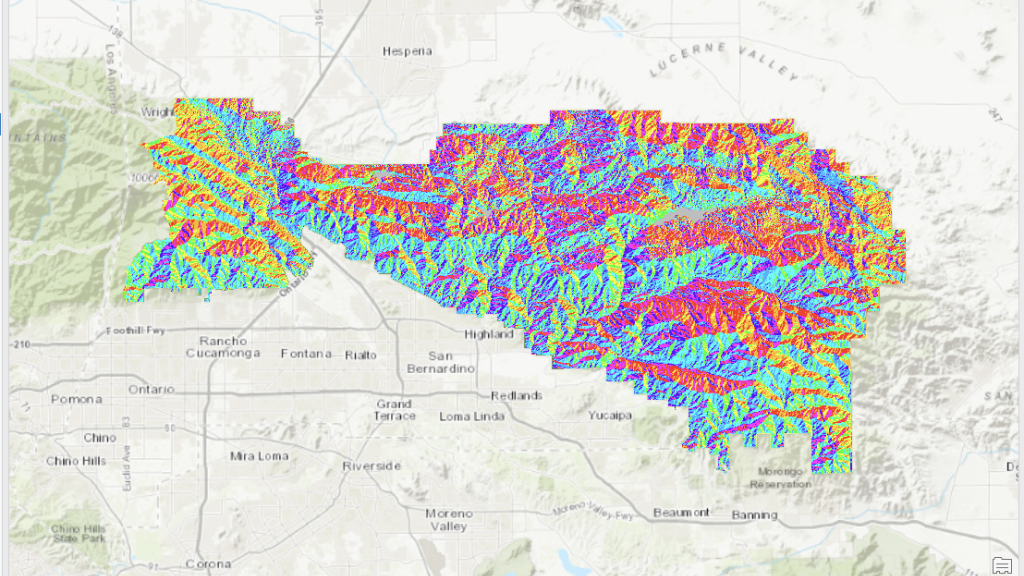
Maps are graphical representations of data. We are experts at finding specific data sets, using your existing data, or even collecting data ourselves.
Print Cartography
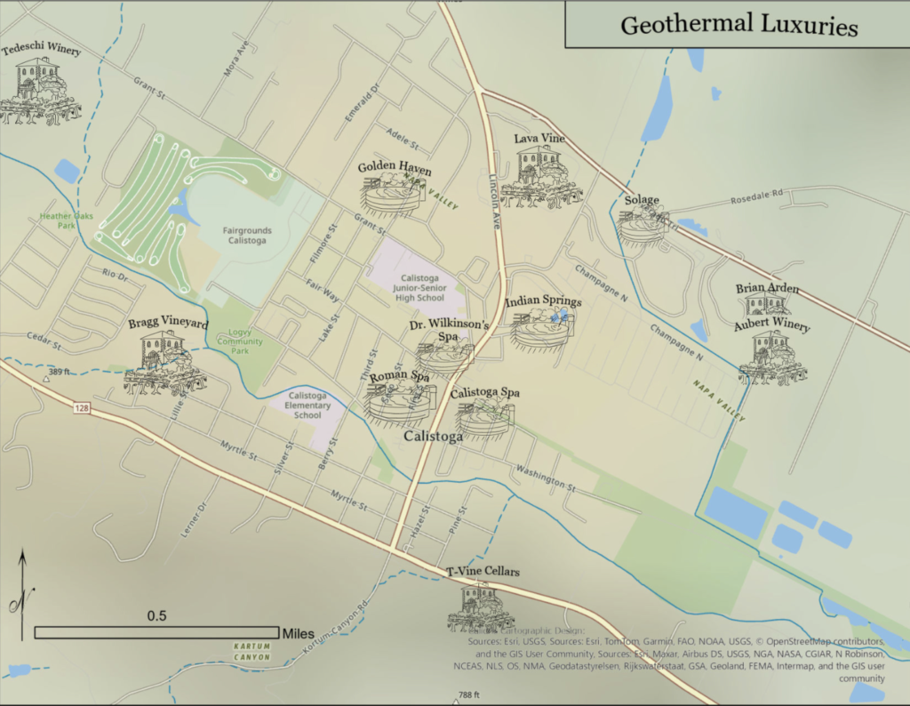
Physical maps of all scales. We employ modern digital and wide-format inkjet printing as well as traditional block style prints.
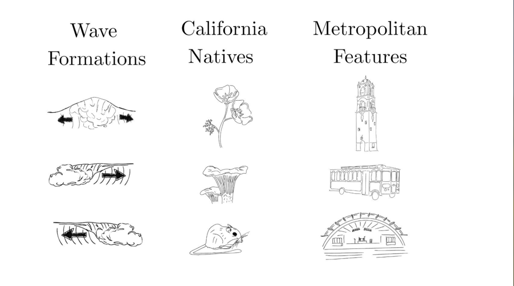
Custom Symbolization
We create unique symbols to represent your maps specific needs, going beyond standard icons to show certain attributes like size, color, or type.
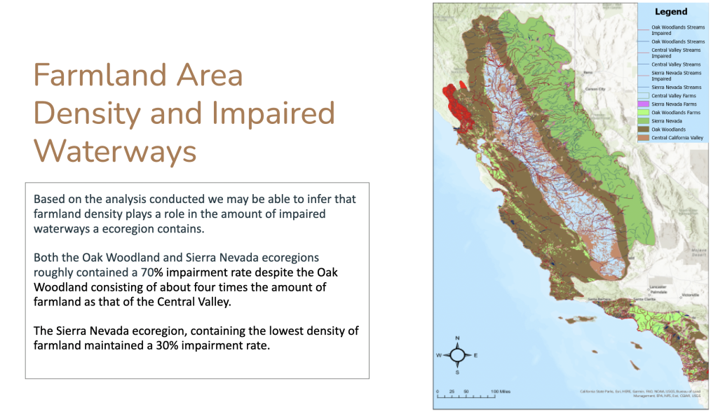
Explanation and Analysis
Calidris interprets map elements to understand spatial relationships and patterns to curate custom reports for all audiences.
3D Map-Making
Expert craftsmanship and use of design tools to create 3D representations of real-world topography.
GIS Analysis, Data Visualization, Custom Physical Maps
Our comprehensive suite of professional services caters to a diverse clientele, ranging from small businesses to large private enterprises or government entities.
Comprehensive Data Access
- Hard-to-find datasets sourced for you. We invest the time and resources to track down specialized or restricted data so you don’t have to.
- Field-ready when the data doesn’t exist. Our team can collect original geospatial data on the ground using industry-standard mobile tools.
- Satellite & aerial imagery integrated seamlessly. We incorporate remote sensing data to add depth and accuracy to any project.
Craftsmanship Combined with Data Science
- Wood relief maps made to order. Each piece is hand crafted from real topographic data, making it both a functional map and a unique art object.
- Block/letterpress printing with a modern edge. A traditional printmaking process informed by accurate GIS data, producing maps with texture and character you can’t get from a digital file.
- Custom to your place and scale. Whether it’s a favorite beach, a private estate, or a branded office installation, we work with you to make something that fits exactly.